Sunday, December 15, 2013

Mamta Rawat: The unsung hero of Bankoli, Uttarkashi


Why is it that when we think of ‘Women of Substance’ we only think of the elite women.  Here is the story of a young brave heart from a small village called Bankoli in Uttarkashi district of uttarakhand. It’s the story 
of Mamta Rawat who in my eyes is truly a woman of substance.


This is her story …Mamta is 24 years old. Having dropped out of school to take care of her mother and her home, Mamta after great struggle managed to do her Basic Mountaineering Course from the Nehru Institute of Mountaineering, Uttarkashi. But, it took her two years after her Basic Course to save up another Rs5000 to do her Advance Course. She did it with the hope that she could get employment in the adventure field. Having performed very well in the Advance course she got a sponsor to sponsor her next course the Method of Instruction course. She then went on to do her Search and Rescue Course. All these courses finally paid off and today she is a professional mountaineer and a qualified instructor. She works as guest instructor with NIM and as a freelancer with INME, a Delhi based adventure sport orgnaisation that conducts training and adventure trips for children.

Mamta, the only earning member of her family is a determined young Gharwali girl who always puts others first and then thinks about herself. Even as her house was getting washed away she preferred to rush out to the help of the pilgrims and other tourists rather than save her house as she was confident that nothing would happen to her family. She was out on rescue missions since the 17th of June with the NIM team and then for the next one month with INME on relief operations.

There are tales of this girl that will mesmerize people. While, on the rescue mission she carried a middle-aged pilgrim woman on her back as the lady was unconscious. She carried her on her back - like a mountaineer carries a rucksack – and ran down the rocky terrain for over 3km to help her get evacuated by a helicopter for further medical treatment. Even when asked what help she required with regard to her house she mentioned that it was nothing but that her village that required rope/cable bridges to cross over the rivers, as all the old bridges were washed away by river. Today she lives with her family of 6 members under a tinned roof.

It is for this brave heart that Summiting4Hope has decided to raise funds and help build her a permanent home where she and her family can live peacefully without any fear. Hers is the only house in her village that has been washed away. Mamta is an outgoing young girl who is ever ready to help anyone in need and always put the needs of others far above her own. Having done so much of her own people and for other that she did not even know, we feel this is the least that we can do for her.


Friday, October 18, 2013

`The expedition to Mt Rudugaira in Gangotri Glacier by Summiting4Hope in association with Uttarkashi based 3Point Adventure Agency was the first successful expedition, post monsoon and the recent disaster in the state of Uttarakhand.


Guneet Puri and Anusha Subramanian

11th October, 2013: Uttarkashi

Our happiness knew no bounds once atop the summit of Mt Rudugaira (5819mts). The 12 member team consisting of Yashwant Singh Panwar (Expedition leader and partner 3 Point Adventure), Deepak Rana (Expedition Guide) Guneet Puri, Saurav Rautella, Pitambar Chandola, Shashi Bahuguna, Udisha Uniyal, Saurabh Dhiman, Vipul Vashistha, Aditya Shinde, Saurabh Dhiman and Anusha Subramanian and one porter – Raju summitted the peak on the morning of 6th October at 9 am.

It was indeed a big achievement for all of us as the conditions were tough. After encountering steep inclines, moraine and winds blowing at speeds of 35kmph the team slowly and steadily climbed up to the summit.

What was more overwhelming for us was the fact that our team was the first team to have summitted a peak in the region post the 16th June disaster. The expedition was conducted in an effort to boost adventure tourism here and also to aid all those people who had lost their jobs in the aftermath of the disaster. 

For all of us mountaineers on the team it was an overwhelming calling to do something in a place we are so very found of. Having spent a lot of our time in Uttarakashi during our mountaineering courses at the Nehru Institute of Mountaineering and also later on expeditions, it seemed only right to give back to the mountains and people who had welcomed us into their hearts and lives.

Post the June 16th disaster most of team members either found themselves already in Uttarkashi or answered the call of the crying mountains to help with rescue and relief operations in the district. With the approaching winter, the need of the hour was to help the villagers get back on their feet, so that they could sustain themselves through the harshest of seasons. The need of the hour was to help rebuild Uttarakhand.

Thus was born Summiting4Hope, the brain child of Journalist and mountaineer Anusha Subramanian. The first project undertaken under this banner was Climb for a Cause: In Uttrakahnd, For Uttarakhand, By Uttarakhand in association with a local Uttarkashi based adventure agency 3 Point Adventure.

The expedition team was flagged off on 29th September by Padmashree Chandraprabha Aitwal, a legendry climber of India who also happens to hail from Uttarkashi. The team set out on its journey to Gangotri on the 30th in a Mahindra Scorpio sponsored by Mahindra Adventures.

The drive was wonderful with the car supporting us all through the narrow, rough and not so perfectly made roads. The Border Road Organisation (BRO) had restored roads that had been completely lost and thus had made it easier for the villagers to be able to at least come down to the Uttarkashi town for their essentials. Also with the winter round the corner most people in the upper reaches come down to Uttarkashi town.

Despite the bumpy drive the view succeeded in making up for the discomfort of the journey. The deep gorges, vivid colours, the now calm Bhagirathi River, all made the mountain seem to come alive and beckoned us further into its lap.

The landscape was breathtaking all the way till Gangotri; passing through the quaint villages of Harshil and Dharali which are famous for their apple orchards. Gangotri is also a beautiful little temple town. What’s interesting here are the rock formations, especially in the river. It’s something one would have never seen before. They are huge single boulders, smooth in shades of brown and grey, with depressions in them, as though someone has left finger marks in clay dough.

After a good night’s rest at Gangotri (3140m), the team along with the cook and the porters set out for our expedition on the morning of October 1. The trek from Gangotri to our first camp - Nala Camp (3450m) was a steep climb with several landslides on the way, vestiges of the June 16 disaster. After a neat 4 hour walk we had gained a height of approximately 300 meters on the first day.

The next morning we set out for our Base Camp which was situated at a height of 4450. It was a treacherous and steep climb and we gained a height of nearly 1000 meters that day. The walk th ough treacherous was breathtaking. We had the Bhagirathi river flowing on our left, glimmering like a thousand diamonds under the midday sun, and the mountain ranges flanking us on both the sides of the valley, showing off a spectrum of colours, dark green pine forests, orange to brown till finally red alpine meadows higher up, and the whipped cream and chocolate flakes, like snowy tips.

The team having seen two extremely strenuous days of walking while trekking up to Base Camp, decided to rest for a day to get better acclimatised. Thus instead of going straight up to the Summit Camp we decided to set up an Advance Base Camp (ABC) as well.

We left from Base Camp for ABC on the morning of October 4 at around 9:30am. The entire team was at ABC at around 10:30am. The terrain was slightly grassy with hints of moraine. There was also one place where we had to descend into a "nala" and then climb straight up an incline of about 50 degrees. The ABC (4600m) was set up in a ground on the other side of this ridge.

After setting up the team's tents and the kitchen tent we went for a small acclimatisation walk that also served as a scouting trip for the next day's trek up to Summit Camp. The weather was as we had faced every day, bright and sunny in the mornings and overcast during the evenings.

The morning of the 5th was bright as well and the team wrapped up ABC and started moving towards Summit Camp (4800m) at 9:30am and reached at 11am. The terrain from the ABC to Summit Camp was completely moraine. After the camp was set up the team went for a short walk to acclimatise and to scout the route to the summit.

After lunch the weather started turning bleaker than usual. By 3pm there was a white out and as we waited for the tea to boil it got increasingly worse. At around 5pm it started snowing in earnest. There was also severe thunder and lightning. We were quite worried at this point and there was a general low feeling in the group till dinner time.

Then the weather started cleaning up and the team called an early night in anticipation of the early rising call the next morning. The team set out for the summit on the treacherous moraine peak, from the Summit Camp at 5.30am and reached the summit at 9am.

The morning of the 6th was a clear one but it was extremely cold till the sun came up. Even after the sun came up the day proved to be windy, with winds blowing at speeds of around 35kmph.

The terrain was rocky with moraine and there were several patches of slippery slate. We encountered snow only about 150m from the summit. Some amount of front pointing and side stepping was involved in getting to the top but at 9am the last feet of the team stepped atop the summit of Mt Rudugaira (5819m).

Though tired there was a general atmosphere of triumph and jubilation among the team members. After the initial rounds of hearty congratulations and many more rounds of celebratory hugs the team sobered down for the Pooja at the summit thanking the gods for the excellent weather as well as the mountain for letting us sneak up to her summit. Incense was burnt, offerings of coconut scattered and Tibetan prayer flags were also tied at the top.

The team spent another half hour or so taking pictures and videos on the summit and then started the slow and cautious descent to Base Camp. We stopped at the Summit Camp to have tea and wrap up the camp. The next stop was to wrap up the ABC where we also had lunch. The entire team was safely back at Base Camp at around 3pm after having gained nearly a 1000 meters and descended nearly 1400 meters.

The next day we wrapped up our expedition to Rudugaira and walked back down to Gangotri. With the weight of the expedition gone the team frolicked on the way back. The team reached Gangotri at 2:30pm on the afternoon of the 7th of October.

Where a member stumbled there was another at his or her side to steady them, where someone slipped there was another to pull them up. In this way we proved that even though Uttarakhand has stumbled we are still here to help her back on to her feet.

eom


Sunday, August 4, 2013

Uttarkashi Update: Women’s health issues need immediate attention: Urgent Call for Lady doctors

There are several problems faced by women in rural India. Uttarkashi district in Uttarakhand is no different. The situation has only gotten worse here after the flash floods struck the district and the state as a whole in June 2013. Aditya Shinde, a mountaineer and who is currently on Relief operations in Uttarkashi on behalf of Sahil, a Pune based NGO says: "That there are several medical problems and most of all those faced by women". 

Woman’s status and gender norms that are prevalent in the society determine the access to and utilization of health care facilities. "As is understood from district authorities at Uttarkashi, for a population of close to 3.5lacs, this entire district does not have a single lady doctor. Gynecologists are a far cry," says Shinde. 

Most health issues among women emanate out of the fact that they lack knowledge on dietary habits and nutritious food. Most women in the villages are undernourished. Women do not know how much food they need to consume during the time of pregnancy and about the lactation period for women. This leads to high maternal mortality rate among the women. Apart from that most women in the villages are suffering from anaemia and weakness. The latest on ground report from Dr Aditya Banerjee who was there for a week conducting medical camps in remote villages of Bhatwari Block shows that almost 95 per cent village women here suffer from anaemia. Apart from that many women suffer from menstrual disorders such as Leucorrhea, Metrorragia, Dysmenorrhea and Irregular menses.

This is a serious problem and at this point in time there is a requirement for lady doctors who can trek with the relief teams working in Uttarkashi and reach out to the remote villages now even cut off from basic healthcare. Please share this among your network of friends

Tuesday, July 30, 2013

Rebuilding Uttarakhand

There goes an adage that says ‘Rome was not built in a day’ similarly rebuilding of Uttarakhand is going to take a very long time. One cannot imagine a devastation of this nature. While many have been rendered homeless in the affected districts such as Uttarkashi, Rudraprayag, TehriGrhwal and Chamoli, a whole lot have lost their livelihood and unemployment stares at them and how.I would like to give you an idea of the place Uttarkashi where I had stationed myself for relief operations.
Uttarkashi situated at an altitude of 1352 meters is one of the worst affected districts. 40 kms away from Yamnotri and 100 kms away from Gangotri both part of the pilgrimage tour- ‘Chardham Yatra’ has been thriving due to tourism.
Uttarkashi, meaning Kashi of the North itself is considered abode of gods due to the presence of so many temples and ashrams in that one small town. Similar to Varanasi, Uttarkashi is also situated on the Ganges, lies next to a hill named Varun Parvat where there is a confluence of two rivers Varun Ganga and Asi Ganga and has a ghat called Manikarna Ghat. It also has the famous Kashi Vishwanath Temple dedicated to lord Shiva right in the centre of town. Apart for this there is the Kandar Devta Mandir (temple) and Ganga Mandir. Uttarkashi is also famous for the Nehru Institute of Mountaineering (NIM). 
There were several places within the Uttarkashi town that were affected. But, Joshiyara, which adjoins the Uttarkashi town and is situated alongside the Bhagirathi river was worst affected. There are close to 300 households I was told in this small place. It also has the famous temple, Kaleshwar Mandir, dedicated to Lord Shiva. This small village was one of the affected during the recent floods. Several new construction buildings that came along the banks fell like a pack of cards.
Last month many watched helplessly as their homes got washed away. Preetam Gumber, a resident of Uttarkahi town who owns a grocery shop in the market and also runs a hotel Radhika Palace nearby watched helplessly as part of his house situated just on the banks of the river next to the Ganga Mandir (temple) got washed away. He and his family shifted into their hotel which was empty as most who had booked rooms until September had cancelled their trips to Uttarkashi, Uttarakhand.
Similarly, one another gentleman from Joshiyara who had lost everything was seen sitting on the streets staring at his broken home. As I approached him and asked him If I could help in any way, the old fragile and wrinkled gentleman turned around and looked at me and said , “Beta ab main kya chahu. Kuch nahi chaiye mujhe . Joh bhi tha sab chala gaya’. (What can I wish for now. All that I had is washed away). He further added that whether I get ration or anything that is being given as relief does not make a difference to him as he had lost his several years savings and the house he had built. ‘Kahan se shuruaat Karun. Pata Nahi’ (where do I begin all over again I do not understand) he said.  
This is the question being asked by one and all in this Uttarkashi district. Be it a man who lost is home in the town area or Joshiyara or the man who lost his house in the upper reaches of Uttarkashi, both have seen their houses and livelihood disappear in front of their eyes in the floods.
Gopal Thapliyal, project manager at Sri Bhuvaneshwari Mahila Ashram (SBMA), an NGO that has been operating in Uttarkashi for the last 3 decades and has its office in Joshiyara says: “This tragedy has affected the locals a lot. The locals were dependent on Tousirm. Thousands here work as porters, drivers, guides and waiters. But due to lack of business they have been rendered jobless. In most areas affected by the floods, their entire economy is based on tourism. Adventure tour companies that have been helping the locals as well as helped in rescue operations of the pilgrims are left with no work currently. All of them have lost business for this year. For some their losses run into lakhs.
Tourism provides employment, directly or indirectly, to a significant number of the people residing in villages near the tourist spots in Uttarakhand. One is not sure as to whether people will now be willing to come to Uttarakhand at all. 
However, what surprised me is that most are positive in their outlook for future. While they are very clear that they will not move out of Uttarkashi and Uttrakhand they will find means to be able to rebuild their lives.
The task now is how does one rebuild this state?. It’s a mammoth task at hand. 

Friday, July 19, 2013

Uttarkhand Relief Operations


Everest conquerors to the rescue!

A group of ace climbers, which includes Mt Everest conquerors Bachendri Pal and Premlata Agarwal, have quietly arrived in Uttarkashi from across India ” trekking up to villages where even the Army jawans haven't reached, providing essential supplies to marooned villagers who have no food, water or power

 http://www.mid-day.com/news/2013/jun/300613-mumbai-news-everest-conquerors-to-the-rescue.htm


My interview from Ground Zero in Uttarakhand on Harman Radio 
http://harmanradio.com:4444/player/jplayer/tr691889


Climbers on a mission to Uttarakhand

http://www.thehindu.com/todays-paper/tp-national/tp-newdelhi/climbers-on-a-mission-to-uttarakhand/article4883034.ece

Even though media attention has shifted from Uttarakhand, the work done by local NGOs, trekking communities and good samaritans continues, as they try hard to rehabilitate the locals and rebuild their lives from their lost fortunes. We feature their work here not only to create awareness about the remarkable initiatives undertaken in disaster management but also to encourage them and to express our support and gratitude  for their efforts. - 
http://www.thebetterindia.com/7443/tbi-uttarakhand-diaries-relief-work-carries-on-even-as-media-focus-shifts/ 


TBI writer Anusha Subramanian is currently in Uttarakhand, participating in the relief operations and assisting the locals in rebuilding their lives. She reports from the scene of the devastating floods on the current situation in the affected areas, on the aid provided by the administration, and the stupendous work being carried out by trekkers, mountaineers, Indo-Tibetan Border Police (ITBP), army personnel and NGOs. - 
http://www.thebetterindia.com/7406/tbi-uttarakhand-diaries-hope-floats-on-ngos-and-mountaineers/ 

Wednesday, July 17, 2013

Uttarakhand Diaries-Nature's Fury


After spending 22 days in Uttarkashi, on the banks of the Bhagirathi river in Uttarakhand on relief operations my observation is that while we cannot avoid nature’s fury, the destruction to human lives and property could have been avoided. It could have been avoided if there wasn’t rampant construction of dams, roads and unmindful digging and blasting of the hills. It could have been avoided if the River Regulation Zone (RRZ) would have been passed way back in 2002 and then we would not have had so many construction by the river banks. It could have been avoided if the Environment ministry had done proper cumulative Environment Impact assessments (EIAs) and not blindly given out environment clearances. Despite assessment done by the state government that 250 villages in Uttarkashi are in danger zone nothing was done to relocate them to a safer zone. All the assessments have remained on paper. Today, the situation is such that many are dead or marooned across Uttrakhand, scores of villages across the valleys including Uttarkashi are washed away or almost on the verge of being washed away when it continuously pours the next time. The devastation is unimaginable and its going to be practically impossible for the state Government to carry out rehabilitation on such a large scale.
In Uttarkashi district most roads are broken and many are cracked. One large downpour and these could further split in parts. The Borders Roads Organisation (BRO) in charge of building roads is currently filling the craters with mud to create make shift roads. These are not helping as one rain and the next minute the roads are washed away again. For many across the state this kind of devastation has never been seen before. In 2010 and 2012 floods, people did not loose their homes and lands. Though it was bad they could pull themselves back and start life afresh but this time around they have lost whatever little they had and now completely left high and dry.
Garhwal Himalayas, where the maximum devastation has happened, are unstable hills and are still in the process of growing. While trekking to the far flung villages in the Uttarkashi district we passed through several road heads such as Ganghori, Naitala, Maneri where roads are part split and part functional. A closer look at these roads I realized that its unmindful construction of roads. Further blasting them to make tunnels, dams, and other such projects has destabilized the entire mountain range. The ground has become loose over a period of time, and with the heavy downpours, the rocks an the mountains come tumbling down with a humongous amount of slush, which destroys everything in its way. Some villages such as Pilang, Jadaou have their houses in a precarious situation. The houses are in such positions that from underneath its sliding and from the top there is mountain  landslides.
The houses are almost sandwiched in between thus making it unlivable for the villagers. These villages were assessed to be in danger zone and are still awaiting resettlement forget rehabilitation. Villagers say that in 1991, when Uttarkashi, was struck by a massive earthquake, most far villages such as Syaaba, Jadao, Pilang, Loonthru, Bayana all suffered heavy damage. Even last year, a cloudburst caused massive floods in Uttarkashi district. The flood waters of the Asi Ganga river entered the village of Barsu. Sangam Chetti another area in the Uttarkashi district also saw cloudburst last year and there was widespread destruction. A dear friend who lives in Bankoli village above SangamChetti lost her house partly in the last floods and this year the destruction has been worse for her. She has lost both her house and her shop which helped them make ends meet. In another village called Siror, the villagers who had built their houses along the river banks and had also vast stretch of agricultural land have seen their houses crumbling and land getting washed away right in front of their eyes when the flash floods occurred recently. One of the houses that I visited here the river  had cut through his house and destroyed everything and also left back a huge mound of silt. The owner of the house is an old man who lives in that house with his wife and young kids. With nowhere else to go the man and his family lived in fear waiting in hope for some relief to come their way from the Government authorities. Finally when I visited him as part of TRC we handed out a tent and tarpoline along with a solar lantern and some ration so that he could relocate himself in a safer zone along with his family.
It is understood from environmentalists that cloudbursts become catastrophic in areas where where digging, blasting and tunnelling work is taking place.
Its understood from sources that in Uttarakhand 558 dams and Hydro Electric Power (HEP) projects  have been planned that will convert 1,152 km of river length into underground canals. Uttarakhand has a total installed hydro-electric power capacity of 3,426 Mw. Another 95 projects with a total capacity of 12,235 Mw are in various stages of development. Locals indicated that many of the projects around Uttarkashi town on the Bhagirathi river has been stalled for a while now. Data available with Uttarakhand Jal Vidyut Nigam Limited (UJVNL) CPSUs like NTPC, THDC and NHPC are developing around 25 projects with a total capacity 7,302 Mw and the private sector is working on 38 projects of 2,118 Mw capacity. Currently, as per the site 45 projects worth 3164 Mw is under operation in Uttarakhand.
The expanding population, poor land use, destruction of natural vegetaion, increasing strain of developmental projects like dams, roads, tunnels etc have bound to bring severe impact on life and property either during floods or earthquakes.

Monday, July 15, 2013

Uttarakhnd Diaries: Notes from the villages

Chandra Singh Rana, a middle aged man from Jadaou village in Uttarkashi district of Uttarakhand has trekked 18 Kms from his village to get to the road head Mala along with his fellow villagers and from the road head they have had to walk another 35 odd Kms to get to Uttarkashi town and why? To collect relief materials such as tents, torch, water purifier and solar lanterns being provided to them by Various Organisations such as Tata Relief Committee and IN ME.

Tata Relief Committee had initially adopted around 6 villages in this region namely DIdsari- ( new and Old ) , Pillang, Jadaou, Bhayana, Shyaba and Lungthru which are completely remote and cut off from road connectivity and villagers have lost their homes. With at Total of 40 families in Jadau which  amounts to a population of approximately 200 people, the village has lost all access to any kind of connectivity. The village is in a danger zone and despite repeated attempts by the village to ask the government to relocate them nothing has happened. And today the situation is such that they have all had to leave their homes and live in a tent accommodation.

Harikrishna, the village head says, :" it has been over 15 days since the tragedy has struck but no government authorities have visited us yet". Tata Relief Committe's staff  were the first to visit us son after the disaster. They even stayed with us for one night in our village and experienced our plight themselves.."

Due to the difficulty in reaching this village to distribute the relief material, the villagers of Jadau decided they will come to Uttarkashi and collect their own relief  items. Prior to getting relief from TRC, the villagers have been visiting Uttarkashi in the hope to meet the district authorities and get some help. But to no vain.

So far the villages say the government has only set up a medical camp. But more than anything right now what we need is a roof on top of our head and food to eat, they add unanimously.

Similar is the case with villages such as Pilang, Shayaba, Loonthru to name a few. In Shyaaba, the villagers have lost their one main livelihood - agriculture land. Shyaaba. was rich in vegetables. Infact, the Uttarkashi bazaar got its vegetables from Shyaaba. It's understood from the preach and of the village that the annual income of each family was close to Rs 50,000 to Rs 60,000. With the road connectivity having been lost these villagers are also facing the problem of medical aid. Those ailing have not been to come to town for their regular checkups.

This is not the first time that Jadau, Pilang, Shyaaba and the nearby villages are facing this tragedy. In 2010 and 2012 floods too the villagers faced the same issue but it wasn't this worse. After an assessment by the government administration, the villagers were told that they would be relocated. "Twice an assessment of our village was done-in 20010 and in 2012. A proposal for relocation was accepted. We have all the documents but we never relocated and today we have lost everything after this disaster," says Rana from Shyaaba. Since then the assessment has remained on paper. The has been no action taken in relocating them.

The future of these remote villages and hamlets of flood ravaged Uttarakhand seems to be still bleak. No less than 96 villages in Bhatwari block alone in Uttarkashi district are devastated by natural causes in the past and were yet to be relocated. Now the scenario is such the the current devastation has made it practically impossible and crippled the government to be able to rehabilitate such large numbers of disaster hit villages.

The situation of these villages is also extremely backward. In the current scenario, all the men here are unemployed and their first priority as of now is to save themselves and their family.

The kids education levels are extremely low as the teachers don't come full time because these villages are remote. "the kids go to school 3kms away. now that has stopped too as there are no roads and the bridge that they need to cross to get to school has  also broken", says Rana. .

In the current scenario what has also become necessary in these villages is medical aid. INME , an adventure sport company is conducting medical camps in most of these villages. Their team of mountaineers are accompanied by a doctor are examining the villagers and then administrating drugs. Some of the common ailments are skin problems such as itching, stomach problems such as aches and cramps and  diarreah and acidity. Many of them who are already suffering from some ailments have been unable to come to town for treatment at the district hospital.

As of now the villagers say we have no clue what we are in for in the days to come. As of now we are taking each day as it comes, they say.

Friday, June 28, 2013

Uttarakhand Diary


As you leave the main market of uttarkashi it is evidently silent. You can hardly find people ...it seems more like a ghost town....which is so different from what i have experienced in the past when i was here to do my basic course in 2009. The recent floods in uttarakhand has left most stunned and angry. beyond the pilgrimage spots the tragedy has a lot of ramifications for locals, the most important being loss of livelihood. 

Yesterday myself and couple of others who are mountaineers and also some NGO staff from Sri Bhuvaneshwari Mahila Ashram (SBMA) and Tata Relief Trust we went to assess the situation in some remote villages in the upper reaches of Maneri. These villages have lost their homes and livelihood- their agri land. 

A Rapid assessment by SBMA shows that Uttarkashi has 120 villages which have been completely affected. There are no roads for their connectivity to mainland, no electricity and above all no ration to even cook food. This is the third monsoon disaster since 2010 in this region mainly Uttarkashi. After the first two disaster government had identified 250 villages in this region as being in the dangerous zone but still did not take any action in terms of relocating them or doing any thing. 

Currently, Tata Relief Trust has tied up with SBMA and adopted six villages New Didsari, Didsari, Pilang, Jadaou, Bayana and Shyaba. In all there are are a total of approximately 400 families who will be provided relief. 

Yesterday, along with Yash and Guneet ( who were just back from their Mt Thelu expedition two days ago after walking for about 60 kms in 2 and a half days rescuing tourists and pilgrims on their way -- carrying their bags apart from their own 30 kg or more backpacks; we joined the team of SBMA and Tata Relief Trust went to a village called New Didsari which is in a pathetic situation. 

These 400 families are in a helpless situation having lost everything and no relief in site. They have managed to get few packets of biscuits in the name of food. Children have not been used to eating biscuits but, in the absence of solid food have been feasting on biscuits and most kids in New Didsari that we visited had stomach issues such as pain and diarreah and fever. He is no medical aid that has reached these villages yet. 

The villagers are sad, disappointed and angry. Didsari  and the restvof the villages are remote . Didsari is above Maneri on the opposite side. The  access bridge on baghirathi river to their village has broken down, their houses and agri lands washed away and the villagers have shifted to a makeshift accommodation in the school above. In the absence of administration doing anything for the villagers, the villagers themselves have rebuilt some access paths to their village. 

The other  villages are even farther. The only way to get to these villagers is by trekking treacherous mountainous routes.  Pilang is still facing problems with the mountain landslide. Currently access to this village has become extremely difficult . One has not been to get to the villagers. 

"We have lost everything" says Rajeshree Surendra, from New Didsari whose husband is in ITBP posted in Leh. Tata Relief along with SBMA will be providing tents, ration such as rice, dal, tea, salt, sugar, candles, matches, oil, blankets and medicines. Villagers are asking of very basic materials. 

The worst for the villages and for NGOs working on relief operations is how does one reach the relief material to these villages. The only way it can be done is by air dropping. Permission is being sort from the administration to allot helicopters ASAP to air drop relief materials in these villages. Villagers who I spoke to have lost hope in the government and administration and are not even expecting anything from them. Their hopes are hinging on people like Bachinderi Pal and NGOs. They feel atleast that they will get some relief.

Overall scenario in Uttarkashi is devastating and how. Thousands of buildings and homes, bridges and roads have been destroyed in the tragedy. The roads have caved in every 25 mts and the parts of roads that look one can see visible cracks. 

Another aspect of the human tragedy is that the floods have destroyed not just the farmland but also the irrigation system in the mountains, including the network of canals and irrigation channels. The canals are gone, the irrigation system is gone.. this has compounded the loss for the villagers. Potato which is their mainstay agricultural cash crop is supposed to be harvested next one month and villagers have lost this source of income as well. 

The incessant rains that hit the state over three days from June 14, leading to flash floods and cloudbursts, have led to hundreds of deaths and hundreds others are missing. Armed forces , Air Force and ITBP are still on duty trying to locate people and rescuing the ones still stranded. In the last two days with the weather smiling upon Uttarakhnd with clear skies rescue operations have been good. 
Sorties have been flying to and for nonstop.  

It is understood that the state earns around Rs.2500 crore year through tourism. Trekking companies have had to cancel all their treks and expeditions which is a huge loss. One company apparently which does treks in the Nandadevi and Joshimat area has suffered a loss of Rs 10 lac due to cancellation of trips. Another local company that I spoke Ito in Uttarkashi is currently facing a loss of Rs 2 lakhs from having cancelled one expedition. 

Wednesday, May 15, 2013

Himalayan Glaciers receding at an alarming rate.....


Every time I am in the Indian Himalayas and especially where there are glaciers its alarming to find how Glaciers are receding. Today, I read a report in a financial daily on how Mount Everest glaciers are receding. It was reported that recently, at a meeting of the Americas in Cancun, Mexico- a Scientific Conference organized by the American Geophysical Union, a studyt was presented which indicated that Mt Everest is losing cloak of ice and snow. Mt Everest glaciers are receding and have shrunk at an alarming rate of 13 per cent over the last 50 years due to global warming, the study says.
This is true of the the glaciers in Indian Himalayas as well. I can certainly talk of the Dokriani Bamak Glacier in the Garahwal Himalayas of Uttarakhand. I was year in 2009 when I was pursuing my basic mountaineering course at t e Nehru Institute of Mountaineering (NIM). Dokriaani Bamak glacier is where we are taken for our ice training.
I was shocked when I was told by one of my instructors that the glacier here was receding at the rate of 1.5-2m every year. I was told that the glaciers 25 years ago extended right up to where we had now set up the base camp. That was shocking as from the base camp to the glacier where we used to go for our Ice training was a neat 2.5 to 3 km walk on moraines. Similar is the case in Nepal. Local mountaineers experience says that the base camp of Everest used to be half an hour trek from the village but now, glaciers have shifted and moved and camp is now three hours away. These intrigued me to find out more. 
According to the information I gathered from the Wadia Institute of Himalayan Geology at Dehradun, Dokriani glacier is one of the well-developed, medium sized (7.0 km) valley glaciers of Gangotri group of glaciers in the Garhwal Himalaya. The glacier was originally mapped in 1962–63 and was remapped in 1995 by the Survey of India. The glacier shows rapid frontal recession, substantial thinning at the lower elevation and reduction of glacier area and volume.
Between 1962 and 1995, glacier volume is estimated to have been reduce by about 20% and frontal area had vacated by 10%. The study revealed that during the period 1962–1995 the glacier has receded by 550 m with an average rate of 16.6 m/yr. However, the yearly monitoring of snout position of the glacier during Gangotri glacier in Uttaranchal.
India’s glaciers are melting fast and the Inter governmental Panel on Climate Change (IPCC), the scientific body meant to study climate change, warned in 2007 that if steps were not taken to check this, there was a likelihood of water shortage in rivers (when needed) and flooding of coastal regions.
According to researchers at the Wadia Institute what was worrying is that the glaciers are losing density... largely due to global warming; the snow is melting faster than it can accumulate as ice, thereby thinning the glacier.
The Himalaya, the youngest and fragile mountain system of the earth, has direct influence on climate control, regional hydrology and environment of our subcontinent. About 17% of its mountain area is covered by glaciers. These glaciers are receding faster than those in other parts of the world
The Himalayan Glaciers and Ice Caps are considered water Tower of Asia since they store and supply water downstream during the dry season. Downstream population is dependent on the melt water for agricultural, drinking and power production. In the long run there is a possibility that the region will face severe drought problems. Farmlands could dry up, there could be lack of drinking water.
If this is the scenario in all probability it could also affect the downstream population economically.


Sunday, April 28, 2013

Blissful ride along the Konkan Coast


It was a new found freedom for me…I had quit my job after six years of being in one magazine. And, the first thing I did after quitting was to take off on a bicycle adventure trip the very next day. Accompanying me was my Friend Deepak Kasthwal and our mean machines ‘our beloved bicycles’. Destination was unplanned all we knew was we shall ride along the Konkan Coast via Alibaug.


December 21, 2012 was the day. We took off from Bandra (West) at 6 am in the morning. Headed straight to the train station from where we were to take a local train to Charni Road and then bike from there to Baucha Dhaka-the Mazagaon Ferry Point. We got the ticket and waited at the platform for the train heading to Churchgate.
While at the station I realized how Mumbai is so not a Bicycle friendly city. We had to literally carry our Bicycles on or shoulders up those uneven stairs from platform no.1 to platform no.4 to get a fast train. As the train arrived, the luggage compartment was crowded. Somehow we managed to get ourselves and our cycles inside the compartment only to realize we had got into a Dadar train. But, we were glad we did that so we decided we would ride from Dadar to Baucha Dhaka- Mazagaon Ferry Wharf.
At Dadar, once again we had to battle our way through the platform, carry our bikes and walk up the stairs to get to Dadar east.
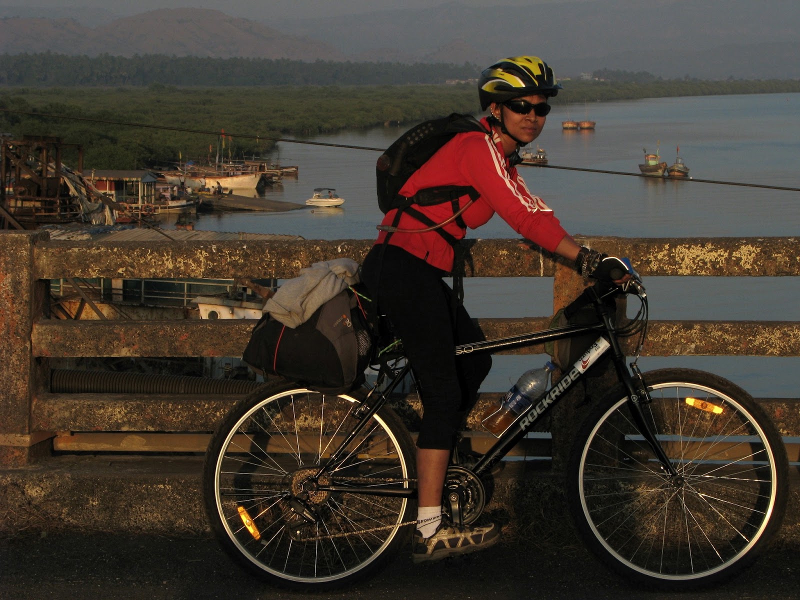
Before we started off on our ride, we had a nice cup of hot tea right outside Dadar station east. Standing with our mean machines and dressed in our biking gear we were obviously the Centre of attraction early in the morning. One thing I like about India and its cities is that people do not wait to make small talks if they see something unusual. In this case we did come across as unusual as we had our backpacks stashed away at the back of our cycles and we were dressed in our cycle gears.
People were keen to know if we were participating in some race, how costly were our bikes and where were we off to and for how long? We battled all these questions till the time we finished our tea and once we were done we took off. It was a nice pleasant ride. We took the port road which was fairly empty that early in the morning. We went via Parel, Kala Chowky, Cotton Green to Mazagaon.
We got the 8.30 am ferry to Rewas. It was a beautiful sail watching the Seagulls eat anything and everything thrown at it including ‘Vada Pav’ and ‘Kurkure’. Once at Rewas, Alibaug is another 23 kms flat pedal. As we rode on the busy streets along the way we managed to stop by and explored. We came across a new factory outlet of clocks-clocks that were got from the Mediterranean and sole real cheap here. So folks when on the road to Alibaug from Rewas look out for this antique clock store on your left……
We reached Alibaug and a bit further down stopped for lunch. Our next destination was Korlai enroute through Revdanda. The route from Alibaug to Revdanda is again through beautiful country side. Since we were only the two of us we rode at own convenience and pace. All along the route we had people and kids screaming out to us in English ‘hi’ , ‘hello’..
After an hour’s hiatus, it was time to go full steam and hit Revdanda. A pretty village with a seaside fort, it also has the Shree Rameshwar mandir and the Revdanda fort.  Shree Rameshwar mandir has an ancient shrine of Shiva and it is said it was built in 'Hemadpant' style of Architecture, though, when it was built is not known. Angre history references say that it was renovated many times. The structure comprises of prayer hall (sabhamandap), sanctum sanctorum and 7.62 meter high summit shaped dome. In front of the prayer hall, there are three tanks (kund) namely Parjanya Kund, Agni kund and Vayoo kund. We stopped by this temple and soaked in the cool breeze and the serene and calm atmosphere.
Further down is the Revdanda fort. 17 kms from Alibag Revdanda is an important port. The Salav bridge at Revdanda which joins Murud and Alibag gives a cool view of the surroundings, You can see a beautiful sight of Revdanda port and beach. The fort was built by a Portuguese Captain by the name of Soj in 1558.
Since both of us had been here before we decided to carry along straight to Korlai. It was past 4.30 pm and we had about 90 min of daylight before halting for the day. Being the first day, we had no intention to push our limits & do a night sojourn. We were sure we would make it to Korlai by 6.
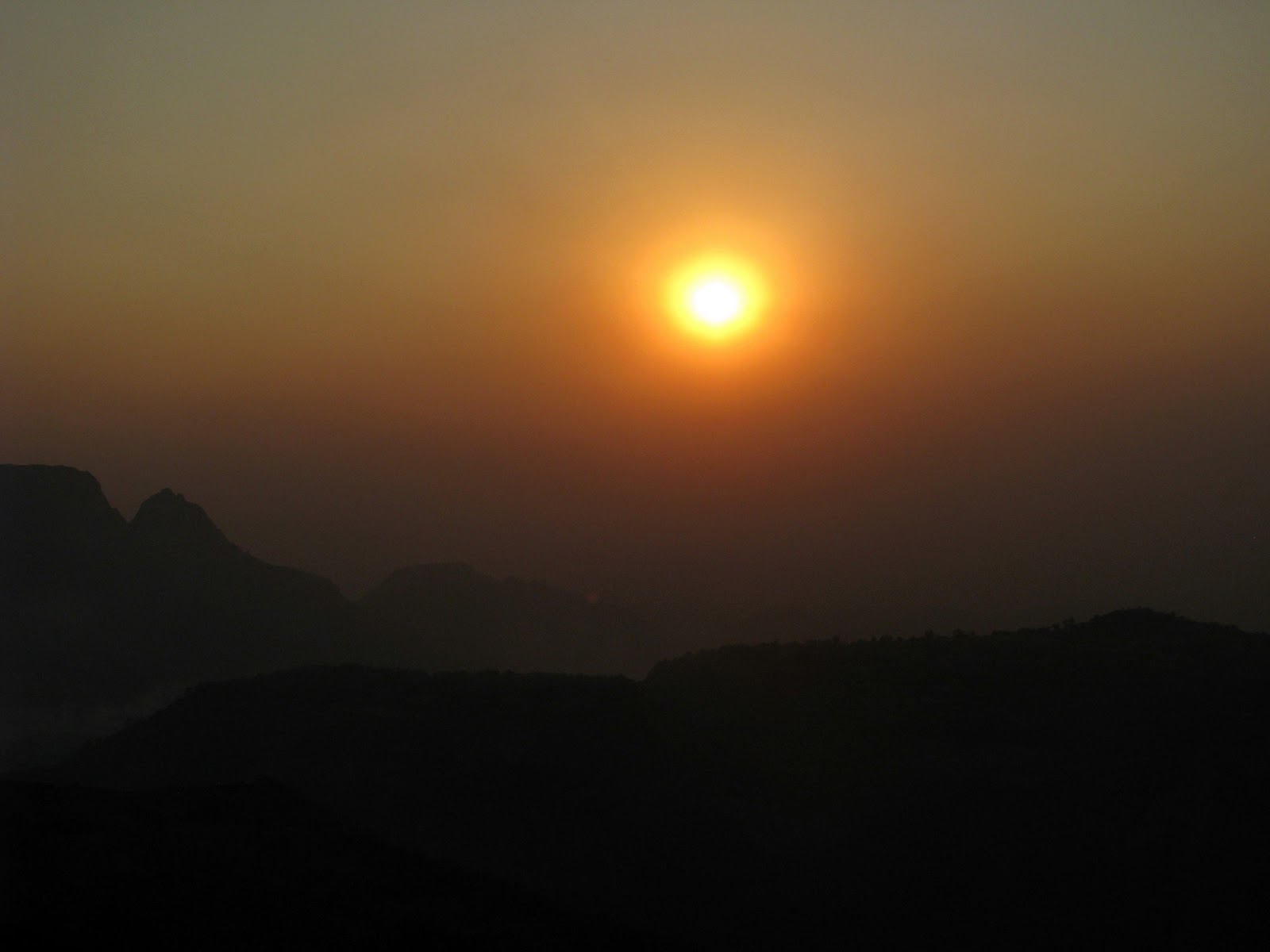
The day’s proceedings evolved into a nicety, with us reaching Korlai by 6.30 pm as the radiance of dusk cast its shadows on the sandy beach. Korlai is a beautiful quaint and lesser known Portugese enclave on the slopes of Konkan range between Arabian Sea on the west and Revdanda back-waters on its east.
One of the most interesting things about Korlai, is its name. This small island was once called ‘Morro de Chaul’. Morro, in Portuguese, implies ‘a small, rounded hill. The present name – Korlai fort, comes from the village of Korlai on the foothills. This name also comes from the Portuguese – the residents of this fishing village speak a dialect of the Portuguese Creole called ‘kristi’. The word Creole eventually was distorted to Korlai.
The fort is open to one and all to take a walk. There is also a light house which is open to all. The lighthouse is open for visitors between 4 PM and 6 PM, and someone is always present there to help visitors who arrive at the wrong time. One can walk up the winding stairs of the lighthouse and learn all about how the light house functions. It’s fascinating. The guides are very good and knowledgeable.
Once at Korlai village, we were lucky to find a homestay at Yogesh’s place. A good family man with a wife and two kids, he was trying to supplement his income with offering homestay along with breakfast and food. He had recently done up two rooms on the first floor which he was letting out on rent for blokes like us. Extremely, hospitable his wife made excellent dinner that comprised of Rice Bhakri, Gaoti (Village) chicken, some salad, fried fish for Deepak and plain rice. The food especially after a 90 km cycling was just yummmm!!
We crashed soon after dinner as we had an early start in the morning. We were heading to Murud which was a pedal of 32 kms and from there to Rajapur jetty (3kms) and from Rajapur we had to get on a ferry to Digi and from Digi to Diveagar. Digi to Diveagr was another 23 odd kms. So it was going to be another long day of a beautiful ride along the coastline. 
After a good night’s sleep we headed out of Korlai around 8 am. The ride along the long stretch of coast line to Murud was scenic and breathtaking. On the one side was mountains and the other side the Arabian sea. We savoured every moment of it.  We passed through the crowded Kashid beach, then Nandgaon where Dr Salim Ali (India’s best ornithologist) has his beautiful and palatial beach house. The sand on the Nandgaon beah is white and this particular stretch was a virgin beach with the crowd staying at Kashid. I am not a beach person so I don’t really enjoy spending time on the beach.
We did not halt and headed straight to Murud. We wanted to be at Murud right on time for Luch. We lunched at a local hotel by the beach. After lunch we immediately headed to Rajapur jetty from where we took a launch to Digi jetty. From Rajapur there are regular boats that also take you to the Janjira fort which is majestically located in the middle of the Arabian Sea. As history goes- Janjira was a fort which the great Maratha warrior king Shivaji could never capture. That's why his son built the Kasa fort on an island close to Janjira in order to capture Janjira, but that never happened. Janjira fort has stood there for 950 years.
And amazing piece of info for you dear reader is that the fort is built in such a way that till you get about 100 or 200 meters from it, you just can't see the huge entrance.
But first some trivia on Janjira: It's huge and you can easily get lost. There is 20 acres fully fortified. I have never seen a complete fort ever on all my earlier treks in the Sahayadris. Inside the fort there were amazingly two huge sweet water lakes. One can drink water from a deep well. It is crystal clear. What a miracle! Salty water all around and sweet water on the island! I have explored the fort in the past. The stones used to build the fort have taken a battering over the centuries but the joints used to connect these stones are still as they were. The Nizam of this area also built an underwater tunnel right to his palace on the shore. One can even venture into the dark tunnel but you require a powerful torch
Once at the jetty we got a launch to Digi. The sail was good but unfortunately women are not allowed to sit on the open top area as it’s against rules we were told and the boat man can be fined by customs or coast guard authorities. So I had to sit along with the crowd inside.
Once at Dighi, we had to pedal fast to get to Diveagarh before it got too dark. Diveagarh was approximately 23 kms from Dighi jetty. It’s a strenuous ride with some uphill rides. We reached Diveagarh around 7 pm. Since we hadn’t booked a place we went hunting for a stay. And we were lucky to find a place. It was an okay place and we paid 750 for a night which we thought was a little too much. But as they say Beggars can’t be choosers …. Next morning we were heading out to Shrivardhan. We had dinner at a local place which served good fish and chicken and sol kadhi ( a traditional Konkan drink). 
After a decent night sleep, early morning the two of us decided to take a walk along the beach. Little did we know that at that hour it was going to be so crowded, noisy and dirty? I was thoroughly disappointed at the state of that beach. It was no more a virgin beach and it was full of litter. Apart from the beach, Diveagarh is famous for its famous Golden Ganpati temple. Sadly eight months before we were there, the golden ganpati idol was stolen, melted and sold in the market.
We had breakfast at the same local hotel where we had dinner the previous night and headed out to Shrivardhan at around 9.10 am. It was a ride of another 25km to get to our destination. Srivardhan is again a nice, sleepy town like Diveagarh. It was a fantastic ride with lots of uphill as well as downhills. Downhills are great fun you can feel the breeze as you ride.
At our last stretch of downhill towards Shrivardhan, the first village you encounter is Kondivili, a beautiful quaint village just by the vast sea. We reached here at around 11.30 am. The view from the top as we were riding down was so beautiful that as we got closer to the village we decided why not stay here and then we could just do some riding around. Right at the beginning of the village we found this beautiful homestay where the owner lady was also kind of tell us that she can prepare good lunch and dinner and offer us as well. It was an invitation we could not have rejected. So we deiced let’s stay put here. The beach across her house was clean and not a soul. 
Towards the evening we headed for some adventurous ride on the beach. As the sun was setting we rode along on the white sands. It was an amazing feeling which one seldom gets in the city of Mumbai.
Towards the night we decided against going all the way to Shrivardhan. So Kondivili was our last halt and next morning we headed back to Dighi jetty and once again pedaled back on the same route to Mumbai. On our way back we halted at a friend’s place at Nandgaon and also went again to Korlai and explored the fort and the light house all over again with some other friends. And next morning headed straight to Alibaug-Madwa-Gateway of India.
We had done close to 450 kms to and fro over 5 days. It was a pleasurable and great ride along the Konkan Coast with lots of learning as well.

Monday, March 11, 2013

Short Escape!


 I have been waiting for really long to start writing about my travels once again. Despite having traveled so much last year I haven't got down to chronicling it. Don't know why?
But, now I have a good topic to start. Two days ago I went to Matheran, a hill station which is about 90 Kms away from Mumbai. I have fond memories of Matheran. This was the place which introduced me to nature when I was just 7 years old. And, since then I have been traveling to places where the mountains kiss the clouds.
So what took me to Matheran now? Well, it was an invitation from Lonely Planet India for the launch of their Short Escapes from Mumbai guide.
The Short Escape guide is a guide that has been launched in Mumbai, Delhi and Bangalore and it captures all the destinations that are close to these cities. Unlike the usual Lonely planet guide which have small fonts and lots of details, these guides are well designed keeping in mind the travellers’ needs. The guides have a good mix of large pictures and big easy fonts that are easy on the eyes and therefore a pleasure to read. Each of these guides feature 40-45 destinations and are divided by themes such as hills, heritage, wildlife, beaches and resorts. Economically priced at Rs 395 these guides are ideal for someone who is a migrant into these cities on work. But, that does not mean that people of these cities cannot use this guide it is useful to them as well as I know of many Mumbaikars who have no clue which are the places outside of Mumbai.

Now a little about Matheran

Matheran, touted to be the smallest hill station in Maharashtra, is indeed a great escape for the busy Mumbaikars as it is very easy to get here for some pure, clean and fresh air. Sparing a few look-out points and waterfalls, there's nothing much to the hill station. This time around I did notice a few changes at this place. For one the toy train is functional again. Secondly, the road from Dasturi Naka to Aman Lodge which is the first train station after Dasturi to Matheran market is now well laid out. I just hope this road does not extend right till the market place. If it does then the entire charm of trekking on red mud will be lost.  
Matheran is an Eco-sensitive and fragile region and hence motor vehicles are not allowed inside this serene place. Vehicles are allowed till Dasturi Naka from where one can walk to the place that they are staying. As u walk in right at the beginning there is Aman Lodge station, the toy train station that can take you to Matheran station located close to the market place. So if one does not want to take the train (shuttle) from Neral. They can get a train from Aman Lodge. Chugging along in a train that lazily bends around the mountains, breathing in the scents of sweet-smelling medicinal herbs and watching the green cover of the Sahayadris is an amazing experience. This short train journey cuts down on your walk if you are not keen to walk all the way on the red mud.
One thing you need to remember is that the trains operate according to their respective timings. So one will have to go there and check if there is a train. One can also ride on a pony or a horse back to get to the market area or their hotel.
A handful of hotels and homestays are scattered across. This time I also noticed couple of new hotels has started here. Most of the restaurants in the market place now serve Chinese and other kinds of food..
Lonely Planet had chosen the Neemrana's 'Verandah in the Forest for us to stay. The Verandah was initially called The Barr House owned by Col Barr and then bought out by a rich Parsi family in Mumbai who eventually sold it to Neemrana. The house is palatial and has a big garden and a tree house. The rooms are all old British style. It's located amidst the forests and has a huge Verandah and hence the name.
Matheran in all has about 38 points, a lake called The Charlotte lake is the only lake at that height. The place is ideal for lazing around and doing anything. The only activities that visitors here can engage in is to walk further into the mountains and soak in the green foliage.
Some of the famous points here are the Panorama Point from where you can see the Sunrise, the Sunset point. Both the sunrise and sunset view is beautiful as you can see the sun casting a beautiful glint of deep orange across the entire region, The Charlotte Lake and the Pisharnath Mahadev temple are the other places that one can visit while here. The Charlotte Lake is a nice place to sit and read a book. The other points that are worth visiting are the Louisa Point (from where one can view the mighty Prabalgad, Irshal gad and Karnala fort), Rambagh Point, Echo Point to name a few.
Matheran is a quiet, peaceful place, and this characteristic of it has often given rise to the myth that it is haunted. Locals narrate tales of wronged wives and separated lovers who float along the woody paths. While there's nothing to be scared of, such anecdotes complete your trip


How to get there
- Matheran is well-connected both by road and railways. Buses frequently ply to Neral from Mumbai and Pune. From Neral one can avail share a taxi till Dasturi Naka. A toy train from Neral is also available and leave you right upto Matheran station. If not one can also take a train from Aman Lodge which is a 5 minute walk from Dasturi.
- Even though hand-pulled rickshaws and a few vehicles run by the municipality can be found in the heart of the hill station, the best way to experience Matheran is by foot or on horseback.


                          The Pandemic and the Mind  Mental Health is a serious issue over the last few months. Children, young adults to Se...